Reynoldstown is located just south of the MARTA and CSX line, between Cabbagetown to the west and Edgewood neighborhood to the east. The neighborhood is bordered by Pearl St., Moreland Ave., and extends south from the rail line to I-20. The Beltline bisects Reynoldstown, stretching south from Wylie near Flat Shoals to Memorial Drive at Bill Kennedy Way.
The neighborhood has a rich history having been founded as one of the first freed slave communities in Atlanta. It is listed on the National Register of Historic Places, posted here. The neighborhood website is: www.reynoldstown.net
BARS, RESTAURANTS, ENTERTAINMENT
- Park Grounds – this coffee shop/dog park also serves food, sandwiches and wraps, beer, wine, and liquor though a limited selection. It is a favorite hangout of local dog owners on nice days.
- Homegrown – delicious and conscientious diner fare, meat-eater and vegan friendly.
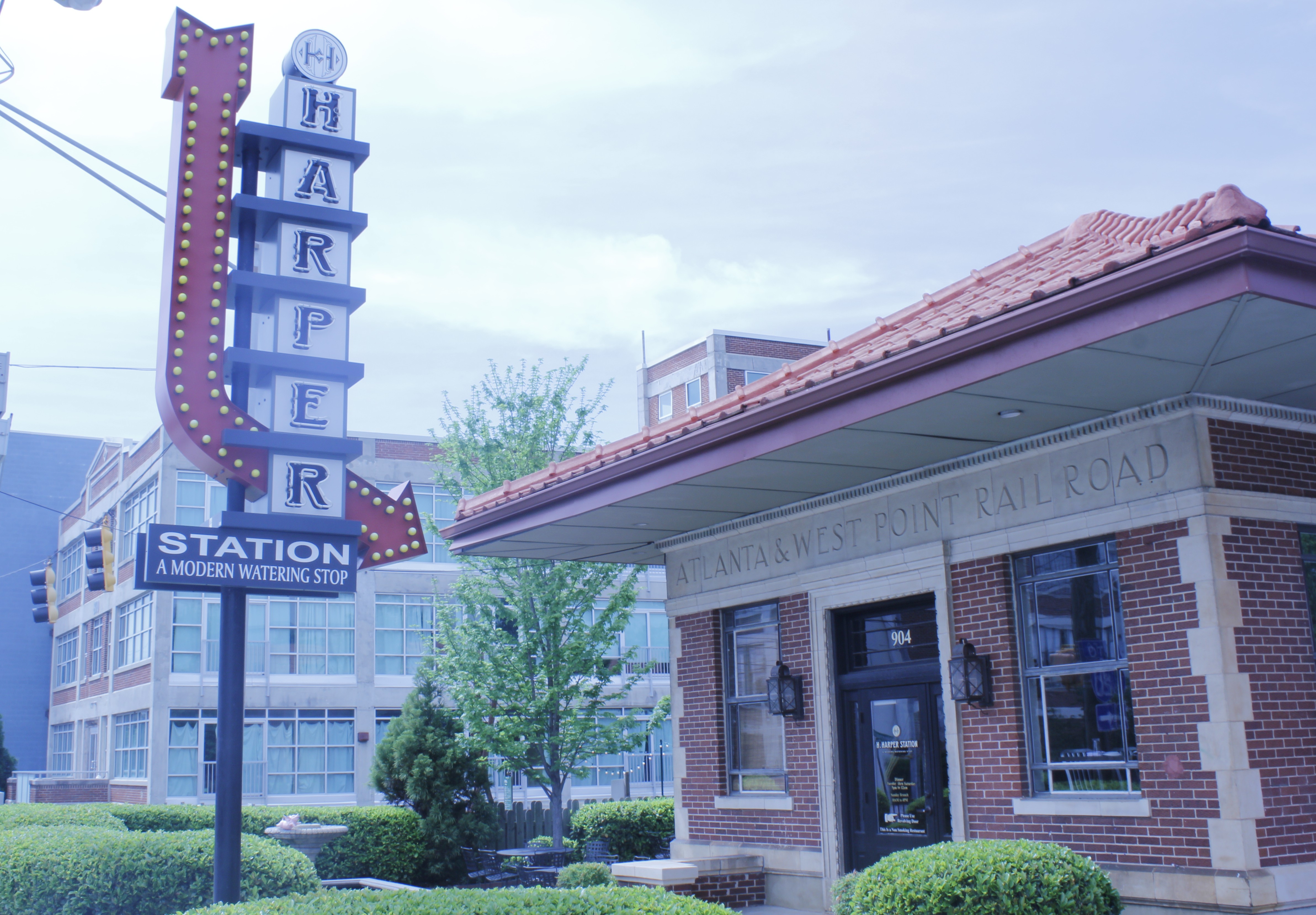
- H. Harper Station – this cocktail bar and restaurant is housed in the old Atlanta and West Point depot on Memorial at the Beltline.
- WonderRoot Community Arts Center – non-profit arts organization with a mission to support the arts and inspire social change. Events, classes and artist space are available.
HISTORY
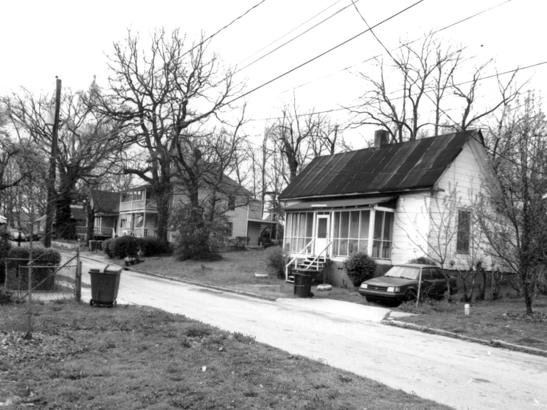
Late 19th century houses on Kenyon St.
Reynoldstown’s history in Atlanta dates to the Civil War when its rolling hills were the scene of the Battle of Atlanta. Its location along the east-west Central of Georgia Railroad and the high points with a clear view to downtown gave the area a strategic advantage. Several of the neighborhood streets are named after military leaders in the battle and historic markers in the eastern portion of the neighborhood discuss a few of the specifics. However, the community that is Reynoldstown began in the years after the Civil War as newly freed African-Americans flocked to the city in search of work.
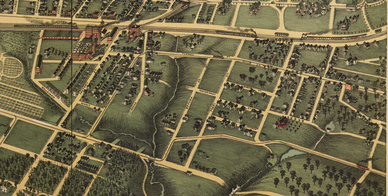
1892 rendering of Atlanta. Reynoldstown is the community on the right, south of the railroad and east of the creek that separates it from Cabbagetown.
An African-American Community
Settlement began around the T-shaped intersection of the Central of Georgia Railroad and the Atlanta and West Point Railroad (now our dear Beltline). This area, consisting of Wylie, Chester, Selman and Kenyon (formerly Oliver) Streets still contains some of the oldest houses in the neighborhood—one-story frame houses dating to the 1880s. The railroad and industries along it like the Fulton Bag and Cotton Mills in Cabbagetown provided employment for this new population.
The area was called Reynoldstown as early as the 1870s after Madison and Sarah Reynolds who were among the first ex-slaves to move into the area. Mr. Reynolds was a prominent landowner in the neighborhood and operated a store on Wylie St. Their son, Isaiah, graduated from Clark College (now Clark Atlanta University) and continued his father’s legacy of goodwill in the are. He constructed a 2-story brick store where he lived and worked, it still stands today, the lone brick commercial building on Wylie at Kenyon St.

Isaiah P. Reynolds store on Wylie
Other commercial buildings in the neighborhood built from the late 19th century on still stand at prominent intersections and along former streetcar routes such as Flat Shoals. Industrial buildings and complexes were built in the early 20th century mostly along the north-south Atlanta and West Point Railroad which was part of Atlanta’s “belt line” by 1900. Some of these industrial buildings still exist, including the Kraft Food building on Memorial opposite the tracks from old Atlanta and West Point Depot (c.1930) and the neighboring A&P company building, now the A&P Lofts. Stein Steel which has been in operation since the mid-20th century lies between the Beltline and Flat Shoals. The belt line railroad connected industries like these to arterial rail lines and the rest of the country.
In the 1880s, the Atlanta Street Railroad Company extended a streetcar line through Reynoldstown. Though not yet electric—the first electric streetcar in Atlanta ran down Edgewood in 1889—this line got the residents to more jobs in the city, many women likely worked as domestics in wealthy homes along Peachtree and in Inman Park by the 1890s.
Racial Tension and New Development
Around the turn of the 20th century racial tension in the city was mounting. Reynoldstown saw an influx of African-Americans to its historic center. Beginning in 1905 landowners and developers such as Coca-Cola’s own Asa G. Candler, began dividing up the undeveloped tracts of land east of the Beltline. Evidence of these later developments can be seen in the house types which exist there, slightly larger frame cottages and bungalows on small lots followed by a slew of the popular Craftsman and Cottage-style homes built in the 1920s found closest to Moreland Ave. and Memorial Dr. Following recent segregation laws, these subdivisions attracted middle class white families. By 1930 the neighborhood as it exists today was developed and was predominantly white despite it’s African-American core. However, white flight occurred swiftly after WWII and by 1960 the entire neighborhood was almost completely African-American, one of the first intown Atlanta neighborhoods to complete the racial transition during this period of suburb development.
Today
Throughout the latter half of the 20th century Reynoldstown remained a largely lower and middle-class African-American neighborhood. But as the population aged and houses, many of which were rental properties, declined, numerous tear downs have made way for new construction infill on the small lots and an influx of younger and more socially, economically and racially diverse residents.
Black and white images are from the 2003 National Register nomination.
Top image of H. Harper Station by April Sisco
