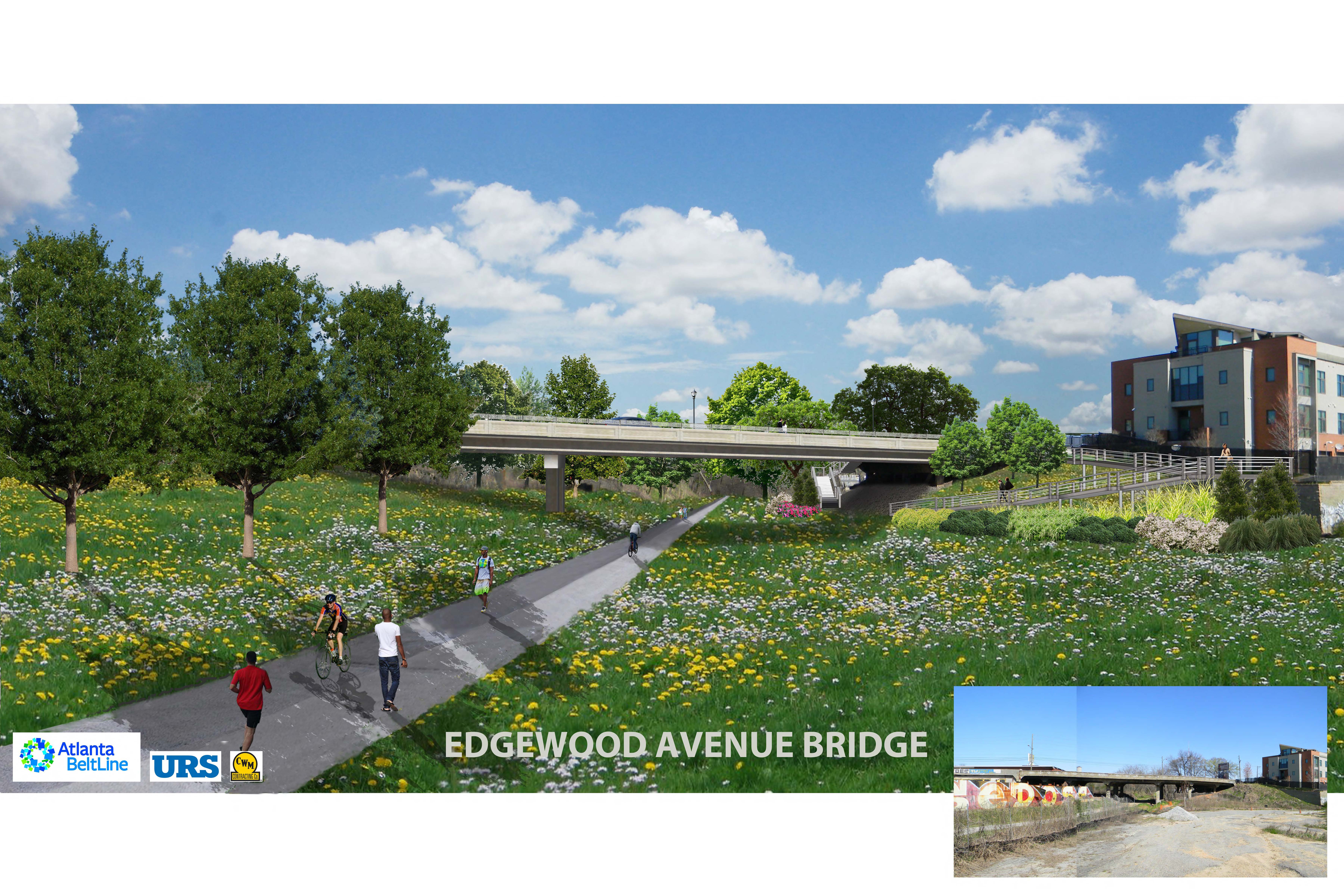
Much to the relief of those of us south of Irwin St, the Edgewood Ave. bridge is still on track to reopen by the end of April. Once again residents of Inman Park, Cabbagetown and Reynoldstown will be connected to the rest of Atlanta west and north of us without having to do some crazy zig zag route via streets like Airline and Ezzard. Best of all, it’ll be simple again to bike to Miso Izakaya, Lotta Frutta, Church or any of the numerous restaurants and bars along Edgewood once we can ride over that bridge. Simplicity really makes things feel closer I’ve found, and Edgewood, with its relatively even pavement, level surface and bike lanes is just that.
But speaking of backroads, if you didn’t know there WAS such thing as Airline St. you soon will, the REALLY BIG NEWS is that the completion of the bridge means that we are all THIS MUCH CLOSER to having a paved Beltline continue through to DeKalb Ave. and ultimately Memorial Dr. As the Beltline folks have promised, as soon as the Bridge is complete, work will begin on paving the trail beneath it extending the current southern end of the Eastside trail from Irwin St. on through to Airline St. and/or DeKalb (see map below). Additionally, ramps will connect bike-friendly Edgewood Ave directly to the Beltline, making connections for everyone to this awesome arterial street (and downtown!) all the easier.
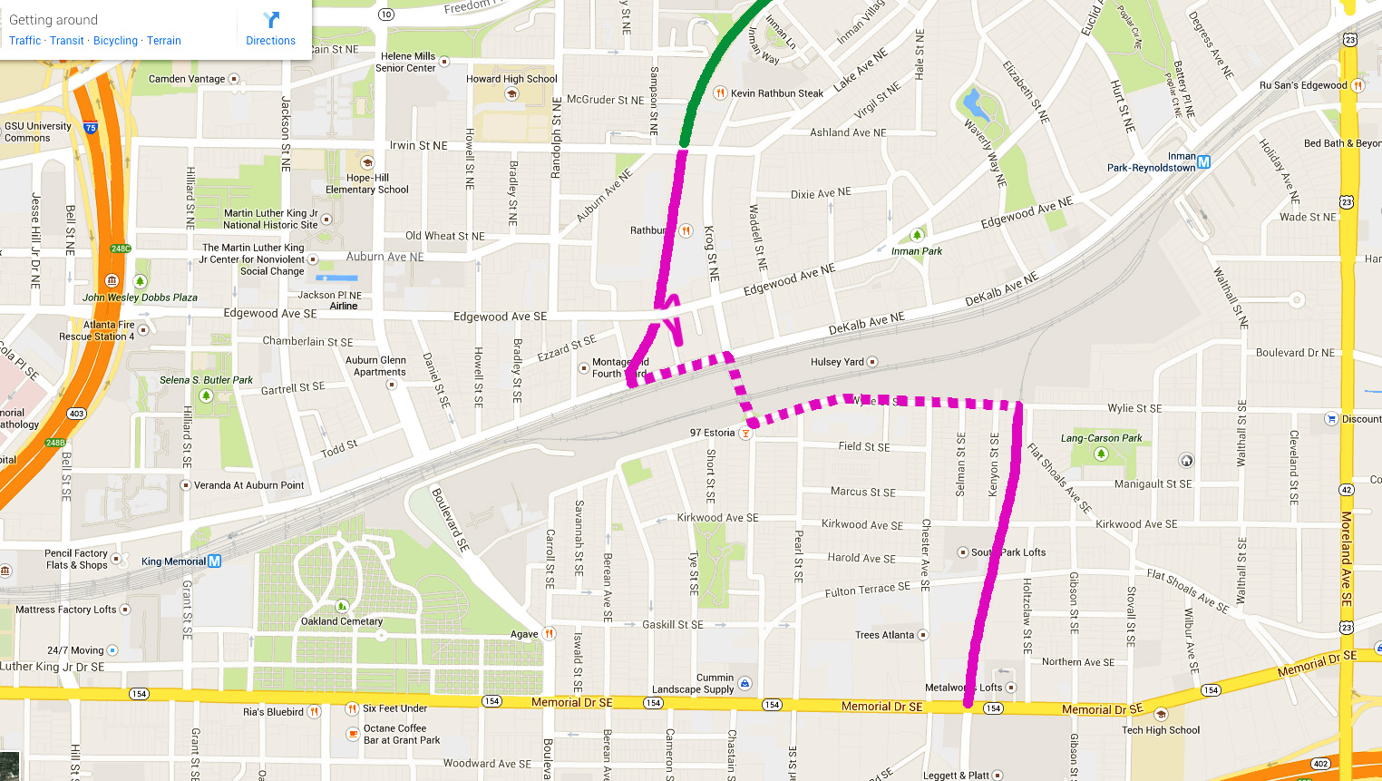
Author’s rendering of future beltline trail from Irwin to Memorial, including road sharing.
From the final end of the Eastside trail at DeKalb, Beltliners will have to leave the paved trail for the sidewalk (pedestrians, joggers) and the street (bikers), travel through the Krog and along Wylie Street to meet the rail-to-trail beltline where it picks up again just past Kenyon St. in Reynoldstown. Where the road must be shared, however, we will be getting marked bike lanes and sharrows (more on that), as well as improvements in the Krog Tunnel. (As an occasional bike commuter through the Krog I must say that I hope they are significant pavement improvements.)
For those of you wondering, it is true that the Beltline may one day be contiguous from the DeKalb trailhead to the Wylie trailhead, zipping under or over Hulsey Yards in some futuristic dream fashion as was first envisioned. However, the realities of getting through that industrial zone are daunting and so at the moment, we must be content with the trail as it is and learn to share the road (not a bad thing either!).
 The Reynoldstown rail-to-trail of the Beltline is no no-man’s land. Just as joggers and the occasional biker took advantage of the Eastside Beltline trail long before it was paved in concrete, we Reynoldstown residents have been utilizing the few block of the old rail bed in our hood for some time. It is a popular cut-through to Memorial, place to walk the dogs, and attracts some of the best Art-on-the-Beltline, official or not I’m never sure. But mainly for the reason of the hills encountered on a north-south transit of Reynoldstown or Cabbagetown I am looking forward to the paving of this through route, which will deliver one safely to Memorial Ave, handy to H. Harper Station, Glenwood Park and, if it’s a particularly nice day on to East Atlanta.
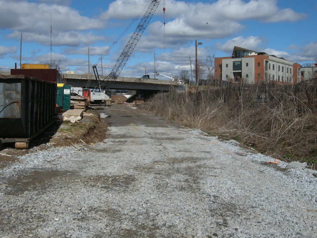
For a while, this is where the Beltline trail will end.
I’m telling you, the possibilities are astounding. The opening of the Eastside Trail has already done so much good connecting residents of a few intown neighborhoods with Midtown, in the coming months we’ll see the Beltline mission really coming to life as the trail reaches deeper into Atlanta’s urban neighborhoods, bringing more of us together.
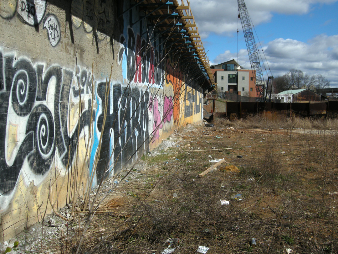
Below are some photos of the progress so far from Friday, March 7, 2014 and I urge you to keep up with the Edgewood Bridge Construction progress at beltline.org and look to Curbed Atlanta’s Beltline Beats for other updates.
For a thorough photo guide of the plans for the Beltline from Irwin St. to Memorial Dr. see Curbed Atlanta’s How the Beltline’s Next Phase Looks Right Now
Beltline.org naturally has a good page on the Edgewood Avenue Bridge Replacement Project
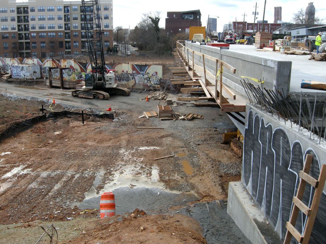
The new Edgewood Bridge, looking down on the south side
Looking along the bridge from Airline St.
Edgewood Bridge, the south side from the future trail

Speak Your Mind